Atlantic hurricane season - Tropical Storm Gordon and Disney World rain
Tropical Storm Gordon is bringing heavy rain to Florida but could strengthen further as it moves over the Gulf to the central southern States later on Tuesday.
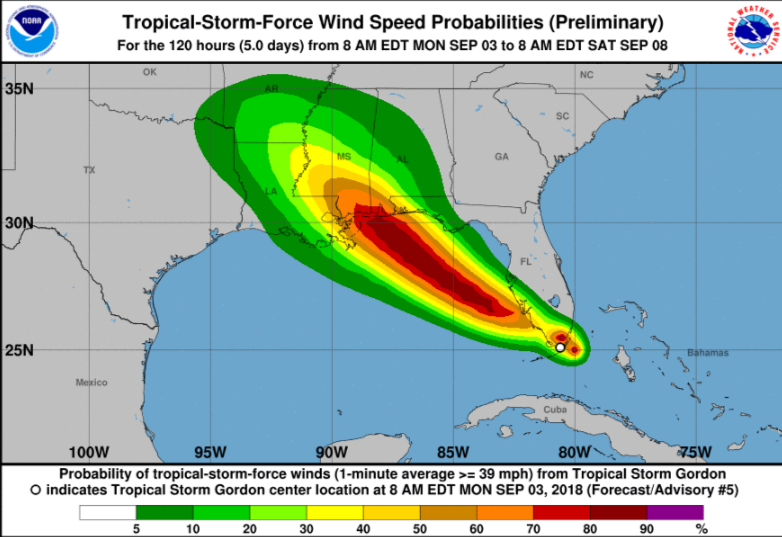
After a quiet start, the Atlantic hurricane season is beginning to pick up. Newly formed Tropical Storm Gordon is forecast to bring heavy rain over southern Florida today before moving across the Gulf to the central southern states of the US. Some of this rain is already visible on the rain radar.
Louisana, Mississippi, Alabama and the Florida panhandle all have tropical storm warnings for Tuesday / Wednesday as does the far south of Florida for Monday. Anyone at Disneyworld, Orlando might have a soggy trip at the start of the week, but this area is not the main focus for Gordon.

It is possible that Gordon could peak as a Category 1 hurricane after 36 hours, just before landfall occurs.NHC
A hurricane watch has been issued for portions of the central Gulf coast. Hurricane conditions are possible later on Tuesday or on Tuesday night.

A life-threatening storm surge is expected later on Tuesday after Gordon has moved across the Gulf of Mexico. Residents are being urged to prepare and listen to advice.
Heavy rainfall from Gordon will affect southern Alabama, southern Mississippi and Louisiana, where totals could reach as high as 8 inches. This rainfall could cause flash flooding.NHC

Atlantic Hurricane season discussion on the Netweather Forum

