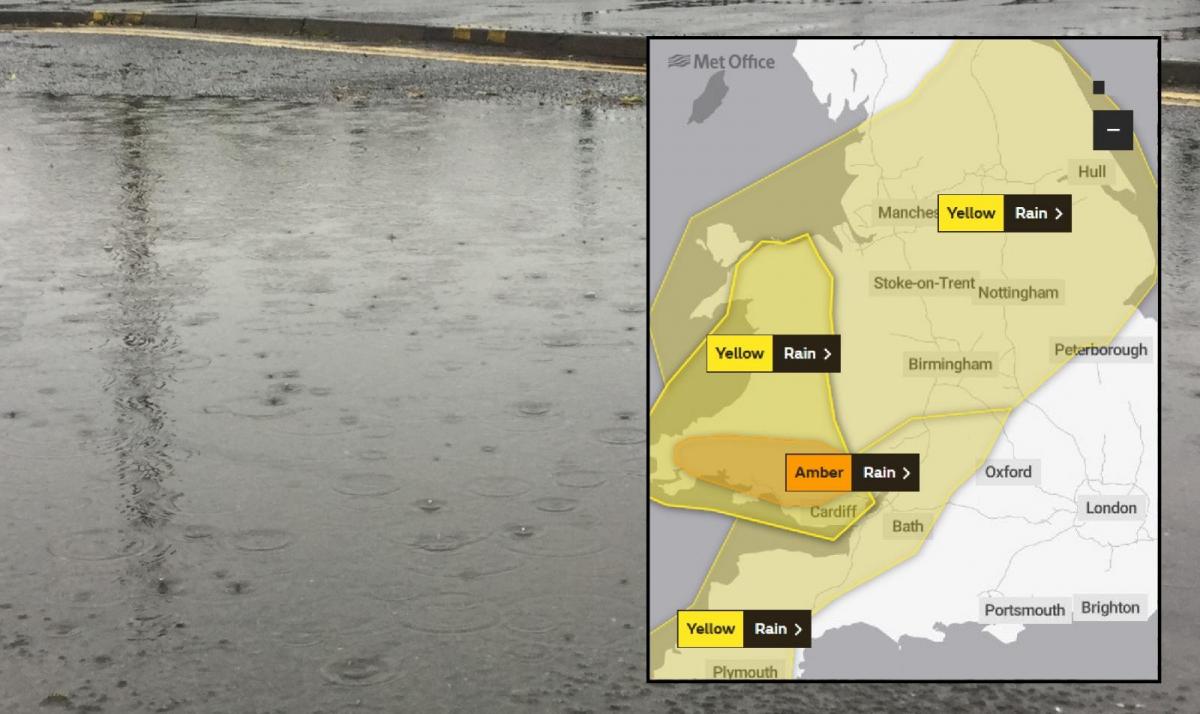
Late October heavy rain and flooding with an Amber warning for south Wales
What an end to the week and certainly not ideal for Half Term. Heavy and persistent rain with the risk of flooding is forecast to continue overnight into Saturday.
10pm 25/10 A rash of flood alerts for Wales with two flood warnings in the far south. More warnings for England too. Police and councils still asking people to only travel if necessary in flood hit areas with so much water about.

"The heavy rainfall is forecast to continue until late morning on Saturday 26th October. River levels in the River Twrch at Cwmtwrch are expected to rise overnight and flood impacts are likely. Natural Resources Wales
"River levels are rising at the Buxton river gauge as a result of persistent heavy rainfall. Consequently, flooding of property is expected to begin between late tonight, 25/10/2019, and the early hours of tomorrow morning, 26/10/2019. Areas most at risk are Litton Mill, and A6 at Buxton. Rainfall is forecast to continue until tomorrow afternoon. We expect river levels to remain high until tomorrow afternoon". Environment Agency
And the forecast picture for tomorrow morning around 9am, still more rain.

5pm 25/10 More flood alerts appearing with 15 for Wales and 86 for England. Reports of surface water on roads

3pm 25/10 Early warnings for heavy rain over Wales and NW England have been extended to SW England, more of northern England and the Midlands this week with an Amber warning for southern Wales issued on Friday 25th. With mild air to the south and cold air to the north, a waving weather front is forecast to bring heavy and persistent rain over Wales and England through Friday into Saturday.

"Flooding is probable from rivers and surface water across upland parts of south Wales later on Friday and on Saturday. Local flooding is also possible across the rest of Wales and parts of northern, central and south-west England too. Local river flooding may continue through Sunday and into Monday on some longer, slower-responding rivers. Properties could flood and there could be travel disruption."
As strong winds pick up for Friday evening, conditions for the Friday evening rush are expected to be tricky in places with plenty of surface water and spray, along with sudden gusts. There could even be a little hill snow after dark for the highest routes in of northern England or Welsh mountains.
14:00 25/10 A tidal flood warning has been issued to Lyme Regis harbour by the Environment Agency
"Waves and spray are expected to overtop sea defences as a result of spring tides and strong winds. The high tide is before dawn on Saturday with a F7 SW wind Please stay away from large waves as they are dangerous"
Further updates to come

